Tarhunah
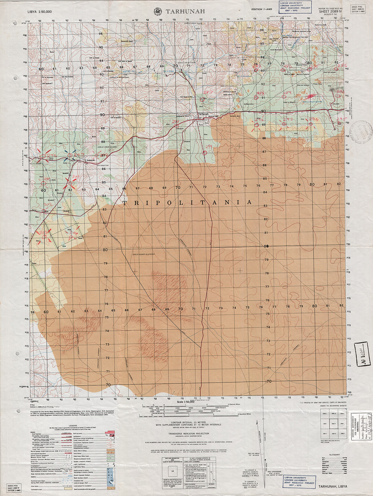
USA, Army Map Service
C.G. IAO
Libia 107
1011
2089 IV
1:50 000
56x74
A Colori
Washington D.C.
Libia
1962
Series P761
United States Army Map Service
Prepared by the Army Map Service (PV), Corps of Engineers, U.S. Army, Washigton, D.C. Compiled in 1962 by photogrammetric methods. Aerial photography May 1954. Horizontal and vertical control by 329th Engineer Detachment (Geodetic Survey). Photography field annotated 1959.